Table of Contents
Information Board 3
Located on the corner of Owletts Lane where it meets Cooks Hill.
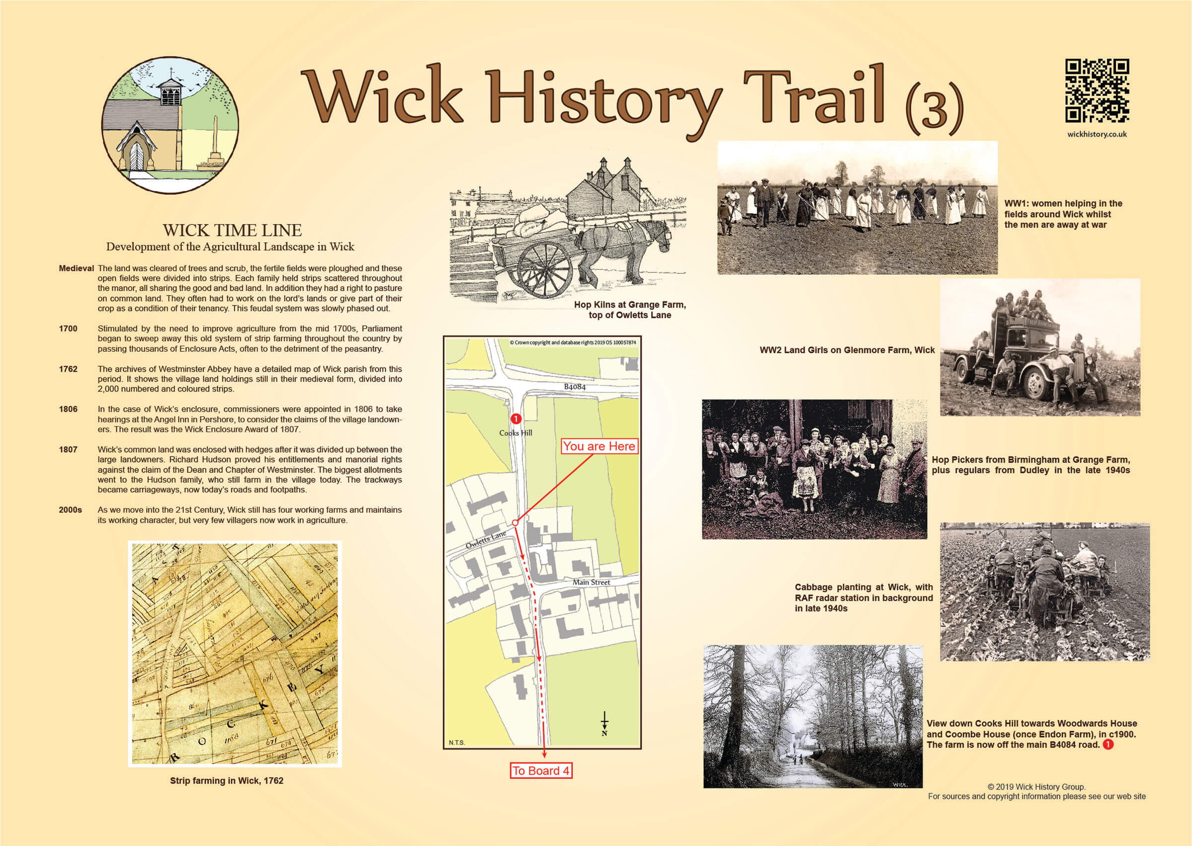
Wick Timeline (3)
Development of the Agricultural Landscape in Wick
| Medieval | The land was cleared of trees and scrub, the fertile fields were ploughed and these open fields were divided into strips. Each family held strips scattered throughout the manor, all sharing the good and bad land. In addition they had a right to pasture on common land. They often had to work on the lord’s lands or give part of their crop as a condition of their tenancy. This feudal system was slowly phased out. |
|---|---|
| 1700 | Stimulated by the need to improve agriculture from the mid 1700s, Parliament began to sweep away this old system of strip farming throughout the country by passing thousands of Enclosure Acts, often to the detriment of the peasantry. |
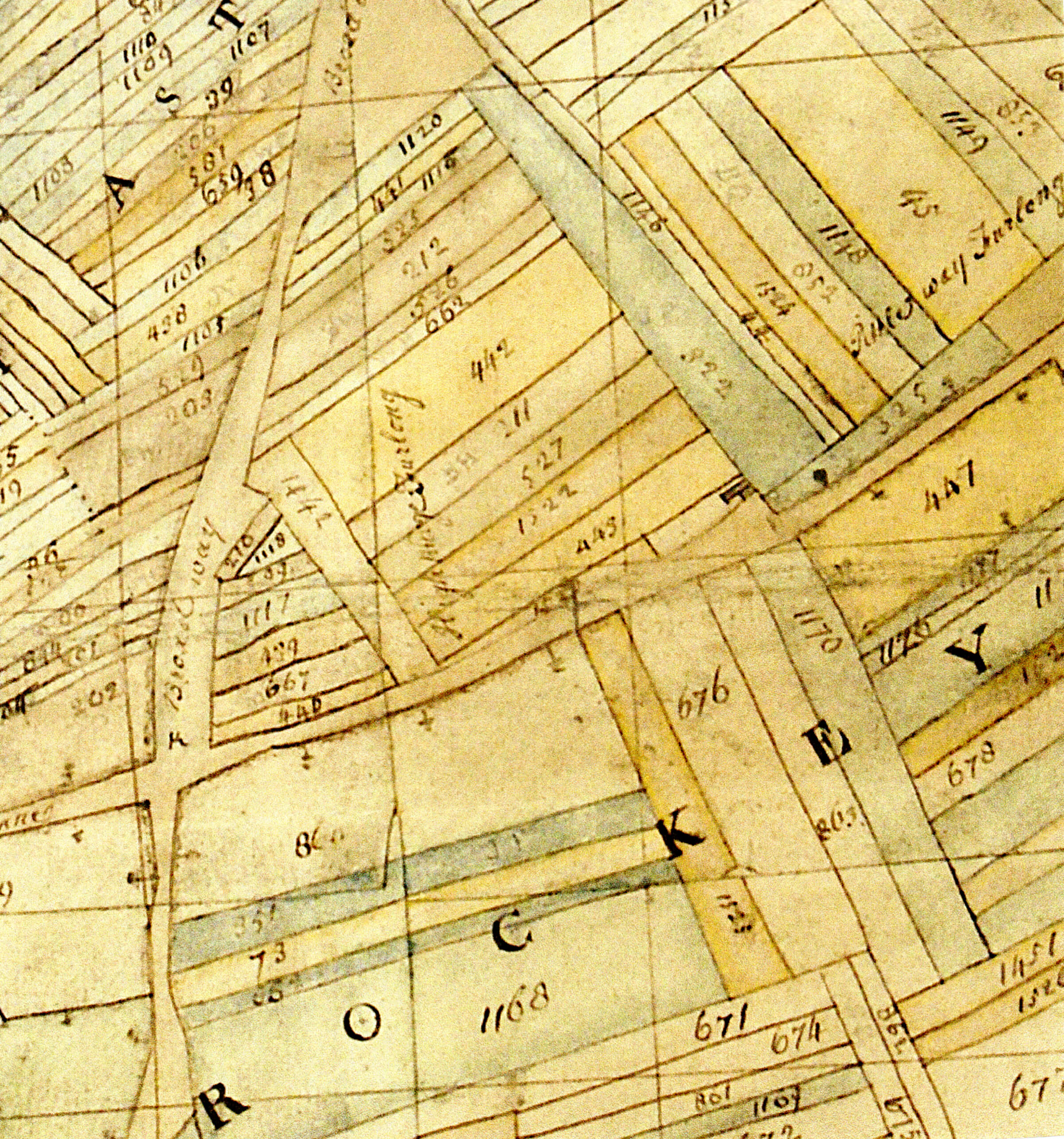
| 1762 | The archives of Westminster Abbey have a detailed map of Wick parish from this period. It shows the village land holdings still in their medieval form, divided into 2,000 numbered and coloured strips. |
| 1806 | In the case of Wick’s enclosure, commissioners were appointed in 1806 to take hearings at the Angel Inn in Pershore, to consider the claims of the village landowners. The result was the Wick Enclosure Award of 1807. |
| 1807 | Wick's common land was enclosed with hedges after it was divided up between the large landowners. Richard Hudson proved his entitlements and manorial rights against the claim of the Dean and Chapter of Westminster. The biggest allotments went to the Hudson family, who still farm in the village today. The trackways became carriageways, now today's roads and footpaths. |
| 2000s | As we move into the 21st Century, Wick still has four working farms and maintains its working character, but very few villagers now work in agriculture. |
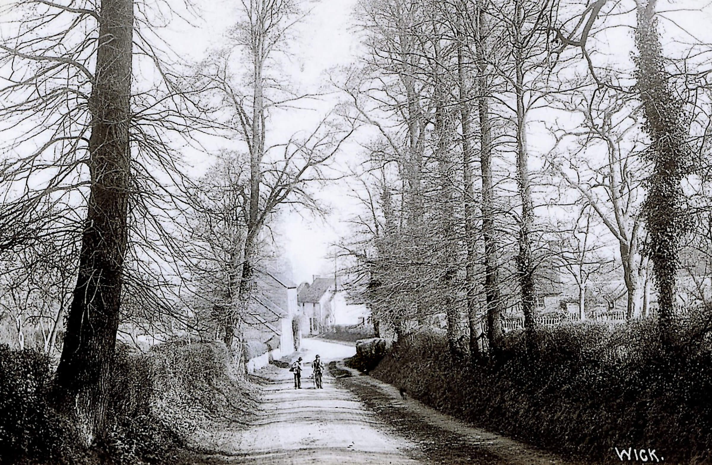
1View Down Cooks Hill
View down Cooks Hill towards Woodwards House and Coombe House (once Endon Farm), in c1900. The farm is now off the main B4084 road.
Farming in Wick
 7 Photos - Click to View